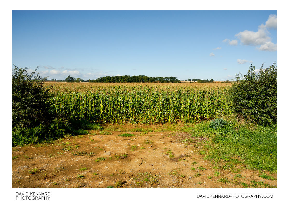
Field of maize entrance, Wycomb

Description
- Title:
- Field of maize entrance, Wycomb
- Caption / Description:
-
Looking west across a field of maize from Wycomb Lane, near Wycomb, Leicestershire, UK.
From Wikipedia (http://en.wikipedia.org/wiki/Maize):
Maize (Zea mays L. ssp. mays, which is known in many English-speaking countries as corn) is a grass domesticated by indigenous peoples in Mesoamerica in prehistoric times. The Aztecs and Mayans cultivated it in numerous varieties throughout central and southern Mexico, to cook or grind in a process called nixtamalization. Later the crop spread through much of the Americas. Between 1250 A.D. and 1700 A.D. nearly the whole continent had gained access to the crop. Any significant or dense populations in the region developed a great trade network based on surplus and varieties of maize crops. After European contact with the Americas in the late 15th and early 16th centuries, explorers and traders carried maize back to Europe and introduced it to other countries through trade. Its ability to grow in distinct climates, and its use were highly valued, thus spreading to the rest of the world.
- Tags / Keywords:
-
- Europe
- UK
- Britain
- England
- East Midlands
- Leicestershire
- Field
- Farming
- Countryside
- Biota
- Life
- Vitae
- Eukaryota
- Rural
- Plantae
- Plants
- Magnoliophyta
- Flowering Plants
- Angiosperms
- Liliopsida
- Monocotyledons
- Poales
- Poaceae
- True grasses
- Zea
- Zea mays
- Maize
- Corn
- Wycomb
Admin
- Date Original Photo Taken:
- Original File Name:
- _DSC1124a.nef
- Event:
- Rating:
- ☆
- Date this image added/last updated on website:
- Original File Dimensions:
- 3813px x 2551px
- File Type:
- JPEG
- Color Mode:
- RGB
- Original Image Color Profile:
- Nikon Adobe RGB 4.0.0.3000
Location
- Location Shown:
-
- Sublocation:
- City:
- Wycomb
- Province/State:
- Leicestershire
- Country:
- United Kingdom
- World Region:
- Europe
- Location Created:
-
- Sublocation:
- Wycomb Lane
- City:
- Wycomb
- Province/State:
- Leicestershire
- Country:
- United Kingdom
- World Region:
- Europe
- Geo-location:
- 52.821181, -0.8492014545 View on map
Rights
- Copyright Status:
- Copyrighted
- Licensing Status:
- Rights Managed
- Available for Editorial Use:
- Yes
- Available for Commercial Use:
- No
- Copyright Notice:
- © 2010 Dave Kennard
Camera Data
- Date Digital Resource was created:
- Shutter speed:
- 1⁄200 s
- Aperture:
- f/7.1
- Camera Model:
- Nikon D200
- ISO:
- 100
- Exposure Compensation:
- 0
- Focal Length:
- 18mm
- Focal Length (35mm equiv.):
- 27mm
- Metering Mode:
- Multi-segment
- Flash:
- No Flash
- Exposure Mode:
- Auto
- White Balance:
- Manual
- Light Source:
- Cloudy
- Exposure Program:
- Aperture-priority AE
Additional shooting metadata
- Lens:
- Nikon AF-S DX Zoom Nikkor ED 18-70mm F3.5-4.5G(IF)
- Filters used:
-
- B+W UV 010 MRC
- Additional Optics used:
- Setup:
- Handheld
Post Processing
- Image Modified:
- Software used:
-
- Nikon Capture NX 2
- Post Processing:
Color Control Point used in CNX2 to brighten and increase contrast of soil
Color Control Point used in CNX2 to brighten and increase contrast of corn
Straightened in CNX2
Curves adjustment in overlay blend mode used in CNX2 to enhance sky
Curves adjustment in overlay blend mode used in CNX2 to increase contrast and saturation
LCE selectively applied in CNX2
