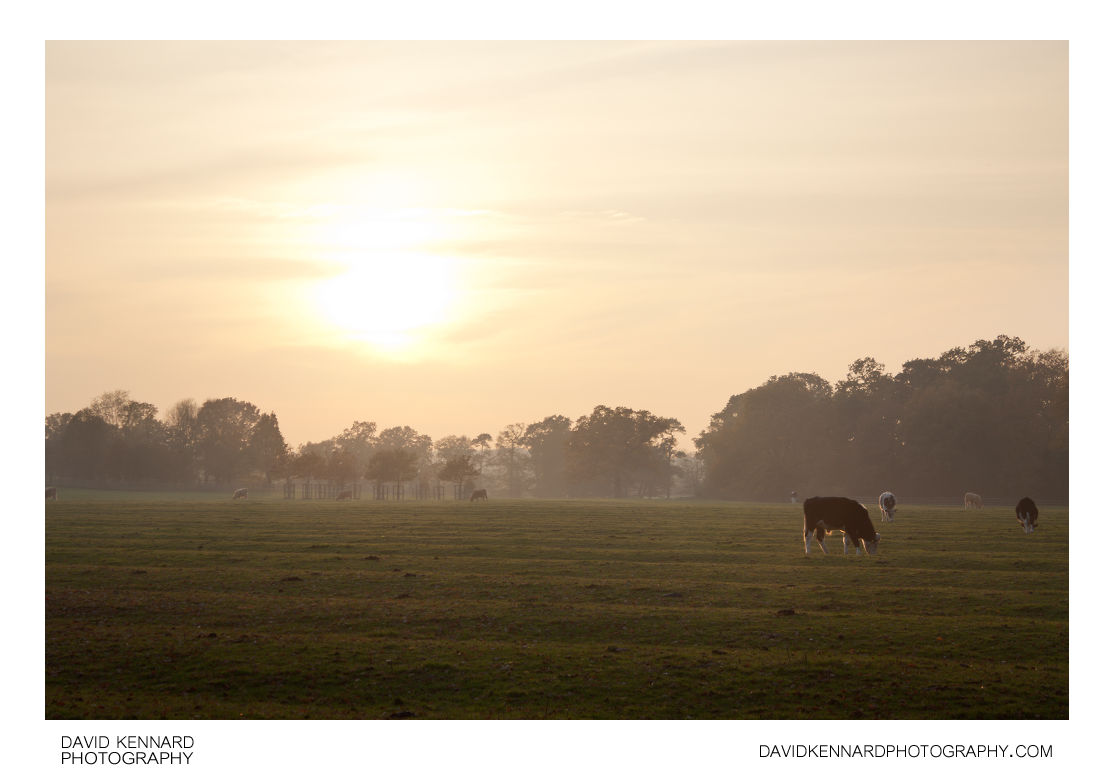
Sunset over ridge and furrow field

Description
- Title:
- Sunset over ridge and furrow field
- Caption / Description:
-
Sunset over the ridge and furrow field to the north of Thorpe Lubenham Hall, in Marston Trussell, Northamptonshire, England. A low autumn mist can be seen forming in the distance, while cattle graze in the field.
From Wikipedia (http://en.wikipedia.org/wiki/Ridge_and_furrow):
Ridge and furrow is an archaeological pattern of ridges and troughs created by a system of ploughing used in Europe during the Middle Ages. The earliest examples date to the immediate post-Roman period and the system was used until the 17th century in some areas. Ridge and furrow topography is found in Great Britain, Ireland and elsewhere in Europe. The surviving ridges are parallel, ranging from 3 to 22 yards (3 to 20 m) apart and up to 24 inches (61 cm) tall – they were much taller when in use. Older examples are often curved.Ridge and furrow topography was a result of ploughing with non-reversible ploughs on the same strip of land each year. It is visible on land that was ploughed in the Middle Ages, but which has not been ploughed since then. No actively ploughed ridge and furrow survives.
- Tags / Keywords:
-
- Europe
- UK
- Britain
- England
- East Midlands
- Sunset
- Biota
- Life
- Vitae
- Eukaryota
- Animalia
- Animals
- Chordata
- Chordates
- Artiodactyla
- Cloven-hoofed ungulates
- Mammalia
- Mammals
- Bovidae
- Cattle
- Cows
- Bovinae
- Bos
- Bos primigenius
- Northamptonshire
- Thorpe Lubenham
- Autumn
- Marston Trussell
- Mist
Admin
- Date Original Photo Taken:
- Original File Name:
- _MG_1320-30.psd
- Event:
- Rating:
- ☆
- Date this image added/last updated on website:
- Original File Dimensions:
- 4270px x 2836px
- File Type:
- JPEG
- Color Mode:
- Original Image Color Profile:
- Adobe RGB (1998)
Location
- Location Shown:
-
- Sublocation:
- City:
- Marston Trussell
- Province/State:
- Northamptonshire
- Country:
- United Kingdom
- World Region:
- Europe
- Location Created:
-
- Sublocation:
- City:
- Marston Trussell
- Province/State:
- Northamptonshire
- Country:
- United Kingdom
- World Region:
- Europe
- Geo-location:
- 52.476266666667, -0.96610833333333 View on map
Rights
- Copyright Status:
- Copyrighted
- Licensing Status:
- Rights Managed
- Available for Editorial Use:
- Yes
- Available for Commercial Use:
- No
- Copyright Notice:
- © 2011 Dave Kennard
Camera Data
- Date Digital Resource was created:
- Shutter speed:
- 1⁄80 s
- Aperture:
- f/6.3
- Camera Model:
- Canon EOS 450D
- ISO:
- 100
- Exposure Compensation:
- +8/3
- Focal Length:
- 55mm
- Focal Length (35mm equiv.):
- Metering Mode:
- Multi-segment
- Flash:
- Off, Did not fire
- Exposure Mode:
- Auto bracket
- White Balance:
- Manual
- Light Source:
- Exposure Program:
- Aperture-priority AE
Additional shooting metadata
- Lens:
- Canon EF-S 18-55mm F3.5-5.6 II USM
- Filters used:
- Additional Optics used:
- Setup:
- Handheld, bracketed ±1EV
Post Processing
- Image Modified:
- Software used:
-
- Adobe Camera RAW
- Adobe Photoshop CS5
- Post Processing:
EV+1 and EV-1 images blended for exposure in PS CS5
